
Be the first to review this product
NORTHERN VERMONT HIKING & BIKING TRAILS

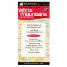
Printed on waterproof, tear resistant synthetic paper. In addition to hiking and biking trails we added small boat put-ins, waterside campsites and mountain biking. Areas covered: Mount Mansfield & Camel's Hump, Little River & Smugglers' Notch State Parks, Camel's Hump & Underhill State Parks, Belvidere Mountain & Lake Willoughby, Burton Island, Jay Peak & Elmore Mountian, Trail & Conservation clubs. Map Features: 29 suggested day trips, mountain biking areas & trails, boat & kayak put-in locations, mileage between points, eight state parks, camping & points of interest, sections of Long Trail & Catamount Trail.
Ratings & Reviews
Be the first to review this product
More from MAP ADVENTURES
-
-
-
-
-
-
-
-
-
-
 MOUNT MONADNOCK TRAIL MAP: SOUTHERN NEW HAMPSHIRERetail Price $8.95